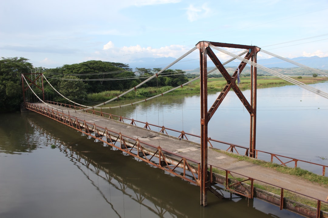
The Old River Control Structure (ORCS), located near Simmesport, Louisiana, stands as a monumental work of hydraulic engineering. Its primary purpose, since its completion in 1963, has been to prevent the Mississippi River from abandoning its current course and diverting predominantly into the Atchafalaya Basin, a process that would have profound economic and ecological consequences for the Gulf Coast region. This article explores the historical context, operational mechanisms, and ongoing preservation efforts surrounding this critical piece of infrastructure, emphasizing its enduring significance for both natural and anthropogenic systems.
The Mississippi River, a capricious and powerful force of nature, has a documented history of shifting its main channel. Geologists and hydrologists have long observed the tendency of the river to favor a steeper, shorter path to the sea. The Atchafalaya River, a distributary of the Mississippi, offers precisely such a path. For centuries, the Mississippi has been “trying” to move west, a hydrological instinct that intensified throughout the 20th century as the Atchafalaya’s channel deepened. The recent developments in the Mississippi River infrastructure have significantly improved transportation and trade efficiency.
The Threat of Avulsion
The primary impetus for the construction of the ORCS was the imminent threat of avulsion. Avulsion refers to the rapid abandonment of an existing river channel and the formation of a new one. In the context of the Mississippi River and the Atchafalaya Basin, this threatened a catastrophic redirection of the main flow.
- Natural Meandering: The Mississippi’s natural meandering process, over millennia, has deposited vast amounts of sediment, elevating its natural levees.
- Atchafalaya’s Advantage: The Atchafalaya, by contrast, possessed a steeper gradient and a shorter path to the Gulf of Mexico, making it a hydrologically attractive alternative for the Mississippi.
- Rising Flow Share: Prior to the ORCS, the Atchafalaya’s share of the Mississippi’s flow was steadily increasing, reaching approximately 30% by the mid-20th century, a significant increase from historical levels. Without intervention, projections indicated it would soon capture the majority of the flow.
Economic and Ecological Imperatives
The potential consequences of such an avulsion were staggering, impacting a vast geographical area and millions of inhabitants. The Mississippi River, often referred to as the “economic spine of America,” serves as a vital artery for commerce and acts as a freshwater tap for numerous ecosystems.
- Port Loss: The ports of Baton Rouge and New Orleans, crucial hubs for international trade, would have their water levels drastically reduced, rendering them largely non-functional.
- Industrial Impact: The petrochemical industry, concentrated along the lower Mississippi, relies heavily on the river for transportation, cooling water, and effluent discharge. A diminished river would cripple these operations.
- Drinking Water Supply: Numerous municipalities rely on the Mississippi for their drinking water supply. A reduced flow would increase salinity intrusion from the Gulf, threatening freshwater sources.
- Ecological Cascades: The Mississippi’s freshwater input is vital for maintaining the delicate ecological balance of coastal ecosystems, including oyster beds, fisheries, and wetlands, which act as natural storm buffers.
The decision to construct the ORCS was therefore not merely an engineering endeavor but a strategic geopolitical decision to buttress the economic and ecological stability of a significant portion of the United States.
The Old River Control Structure in the Atchafalaya Basin plays a crucial role in managing the flow of the Mississippi River and preventing flooding in the region. For a deeper understanding of its significance and the challenges it faces, you can read a related article that explores the intricate balance of river management and environmental conservation. Check out the article here: My Geo Quest.
Architectural and Operational Mechanics
The Old River Control Structure is not a singular edifice but a complex system designed to regulate the flow of water between the Mississippi and Atchafalaya Rivers. It operates as a sophisticated valve, ensuring that approximately 30% of the Mississippi’s flow is diverted into the Atchafalaya, thereby maintaining the hydrological balance.
The Low-Sill Structure
The Low-Sill Structure is the primary component of the ORCS, designed to operate during normal to moderate flow conditions. It consists of eleven bays, each equipped with vertical lift gates.
- Design Principle: The structure’s foundation is situated at a lower elevation than the Mississippi’s natural bed, allowing water to flow over the sill even when the gates are partially open.
- Flow Regulation: The gates are manipulated to control the volume of water entering the Atchafalaya, calibrated to maintain the target 30% diversion.
- Energy Dissipation: Critical to the structure’s longevity is the dissipation of the immense kinetic energy of the flowing water. This is achieved through hydraulic jumps and stilling basins downstream, preventing scour and erosion that could undermine the structure.
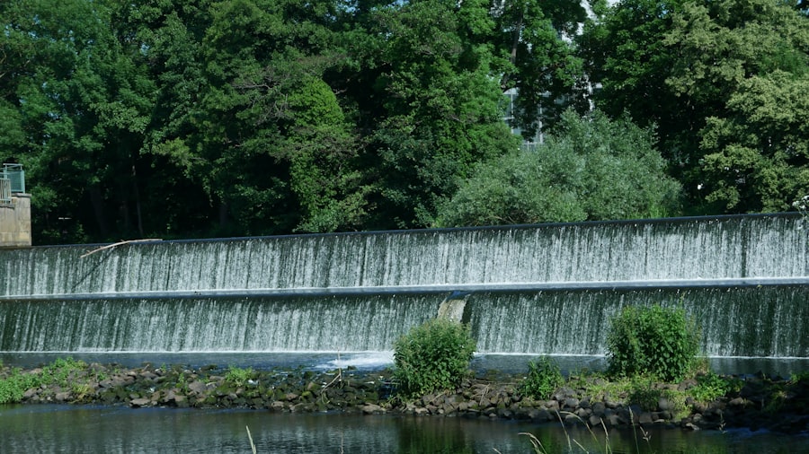
The Overbank Structure
The Overbank Structure, as its name suggests, is designed to operate during periods of extreme high water, when the Mississippi’s flow exceeds the capacity of the Low-Sill Structure and the natural riverbanks. It acts as an overflow weir.
- Weir Function: This structure is essentially a long concrete weir, or dam, with crest gates. When the Mississippi’s water level rises above a predetermined elevation, water flows over the weir and through the gates into the Atchafalaya.
- Flood Control: Its primary role is flood control, augmenting the capacity of the Low-Sill Structure to prevent excessive water levels on the Mississippi and to maintain the controlled flow distribution.
- Sediment Management: While designed primarily for water flow, strategies are also employed to minimize sediment accumulation, which could impair its function.
The Auxiliary Structure and Chute
The Auxiliary Structure and its associated chute were constructed in the aftermath of a near-catastrophe in 1973. A major flood event exposed vulnerabilities in the initial design, leading to significant scour and damage to the Low-Sill Structure.
- Post-1973 Response: The Auxiliary Structure served as an emergency bypass and was subsequently reinforced and integrated as a permanent component, providing redundant flow control.
- Dedicated Spillway: It essentially functions as a dedicated spillway, offering an additional avenue for controlled diversion, particularly when maintenance is required on the Low-Sill Structure or during exceptionally high flows.
- Chute Erosion: The original chute, designed to convey water from the Auxiliary Structure, experienced severe erosion during its initial operation, necessitating extensive reinforcement and ongoing monitoring.
The Continuing Battle for Stability: Maintenance and Monitoring
The ORCS, like any structure constantly subjected to immense forces, requires relentless maintenance and continuous monitoring. The persistent hydrological pressures exerted by the Mississippi necessitate a proactive and adaptive approach to its preservation.
The Threat of Scour and Erosion
The greatest existential threat to the ORCS is the relentless process of scour and erosion. The sheer velocity and volume of water passing through the structures have the potential to undermine their foundations, leading to catastrophic failure.
- Foundation Integrity: The foundations of both the Low-Sill and Auxiliary Structures are particularly vulnerable. Without stable foundations, the structural integrity of the entire complex is compromised.
- Energy Dissipation Effectiveness: The long-term effectiveness of the energy dissipation features, such as the stilling basins and riprap protection, is crucial. Their degradation can accelerate foundation scour.
- Sediment Dynamics: The interaction between sediment transport and flow conditions can exacerbate scour in some areas while causing unwanted deposition in others, affecting operational efficiency.
Structural Integrity and Rehabilitation
Regular inspections, repairs, and rehabilitation projects are integral to the longevity of the ORCS. These efforts range from routine maintenance to major structural overhauls.
- Gate Maintenance: The large vertical lift gates in the Low-Sill Structure and the crest gates in the Overbank Structure require frequent servicing, including lubrication, seal replacement, and corrosion control.
- Concrete Repair: The concrete elements of the structures are subjected to constant abrasion, cavitation, and freeze-thaw cycles. Spalling, cracking, and deterioration necessitate ongoing repair and reinforcement using advanced concrete technologies.
- Instrumentation and Sensing: A network of sensors monitors critical parameters such as water levels, flow velocities, gate positions, and structural deflections. This real-time data is vital for operational adjustments and early detection of potential problems.
Adaptive Management Strategies
The ORCS operates under an adaptive management framework. This involves continuous learning from operational experiences and modifying management strategies as new data emerges or environmental conditions change.
- Lessons from 1973: The near-failure of 1973 served as a profound lesson, leading to significant design modifications and the construction of redundant systems.
- Modeling and Simulation: Sophisticated hydrodynamic and geomorphic models are employed to simulate various flow scenarios and predict their impact on the structures and surrounding environment.
- Interagency Cooperation: The U.S. Army Corps of Engineers, which manages the ORCS, collaborates with other federal and state agencies, academic institutions, and local stakeholders to ensure comprehensive oversight and informed decision-making.
The Broader Ecological and Socioeconomic Landscape

The preservation of the Old River Control Structure extends far beyond its concrete and steel components. Its continued functionality underpins a vast and interconnected web of ecological processes and human activities.
Safeguarding the Lower Mississippi Ecosystem
The controlled diversion of freshwater into the Atchafalaya Basin is not merely about preventing a channel shift; it is about sustaining a unique and biologically rich ecosystem.
- Atchafalaya Basin as a Resource: The Atchafalaya Basin, the largest remaining forested wetland in the United States, benefits from the controlled influx of freshwater and sediment, which nourish its cypress-tupelo swamps and bottomland hardwood forests.
- Coastal Protection: The wetlands nourished by the Atchafalaya’s freshwater and sediment inputs act as a critical buffer, absorbing storm surge energy and protecting inland communities from hurricane impacts.
- Fisheries and Wildlife: The freshwater input is essential for maintaining breeding grounds for fish, shellfish, migratory birds, and a diverse array of wildlife that depend on brackish and freshwater habitats.
Economic Resilience and Security
By tethering the Mississippi River to its current course, the ORCS acts as an anchor for the economic security of the entire region. The river is the lifeblood of a significant portion of the national economy.
- Agricultural Exports: The Mississippi River facilitates the transport of vast quantities of agricultural products from the heartland to global markets.
- Energy Corridor: The energy sector along the lower Mississippi is a cornerstone of the nation’s energy infrastructure, reliant on the river for transport, processing, and cooling.
- Tourism and Recreation: The unique cultural and natural heritage associated with the lower Mississippi and the Atchafalaya Basin supports a significant tourism and recreation industry.
Addressing Future Challenges: Climate Change and Sea-Level Rise
The long-term preservation of the ORCS must consider the evolving challenges posed by climate change, including alterations in precipitation patterns, increases in flood intensity, and sea-level rise.
- Increased Flood Risk: More intense and frequent extreme weather events could place unprecedented stress on the ORCS, demanding even greater resilience and adaptive capacity.
- Sediment Dynamics: Changes in upstream land use and precipitation patterns could alter sediment loads, impacting deposition within the structures and scour downstream.
- Salinity Intrusion: While directly stabilizing the river’s course, global sea-level rise exacerbates the threat of saltwater intrusion from the Gulf into the lower Mississippi and its distributaries, a concern that necessitates further integrated water management strategies.
The Old River Control Structure at Atchafalaya is a critical component in managing the flow of the Mississippi River and preventing flooding in the region. For those interested in learning more about the complexities of river management and its environmental impacts, a related article can be found here: exploring the challenges of river control systems. This article delves into the engineering behind such structures and their significance in maintaining ecological balance.
The Human Element: Dedication and Vision
| Metric | Value | Unit | Description |
|---|---|---|---|
| Location | Old River, Louisiana | – | Geographical location of the control structure |
| Year Completed | 1963 | – | Year the Old River Control Structure was completed |
| Purpose | Flood control and river flow regulation | – | Main function of the structure |
| Flow Distribution | 70% Mississippi River, 30% Atchafalaya River | Percent | Designed flow split between the two rivers |
| Maximum Discharge Capacity | 1,250,000 | cubic feet per second (cfs) | Maximum flow the structure can handle |
| Length of Structure | 2,000 | feet | Total length of the control structure |
| Number of Gates | 5 | count | Number of control gates in the structure |
| Operator | U.S. Army Corps of Engineers | – | Agency responsible for operation and maintenance |
The functioning of the Old River Control Structure is a testament not only to engineering prowess but also to the unwavering dedication of the individuals responsible for its operation and maintenance. Their vigilance ensures this vital infrastructure continues to serve its purpose.
The Operators and Engineers
Behind the concrete and steel are teams of highly skilled operators, engineers, and scientists who meticulously manage the ORCS. Their daily decisions impact the flow of one of the world’s greatest rivers.
- Expert Oversight: The complexities of managing the ORCS require a deep understanding of hydraulics, structural engineering, and environmental science.
- 24/7 Vigilance: The structures are monitored around the clock, with operators ready to adjust gates in response to changing river conditions, particularly during flood events.
- Continuous Improvement: Engineers are constantly evaluating the performance of the structures, proposing upgrades, and incorporating new technologies to enhance reliability and efficiency.
A Legacy of Foresight
The visionaries who conceived and championed the construction of the ORCS recognized the profound implications of an uncontrolled Mississippi River. Their foresight has safeguarded a critical national asset.
- Long-Term Planning: The decision to invest in such a massive and complex project demonstrated a commitment to long-term regional and national stability.
- Balancing Act: The ORCS represents a grand attempt to balance natural hydrological processes with human needs, a delicate act of environmental stewardship.
- Inspiration for Future Generations: The story of the ORCS stands as an inspiration, showcasing how innovative engineering, coupled with persistent dedication, can address monumental environmental challenges and secure the well-being of future generations.
The Old River Control Structure, a silent sentinel in the Louisiana landscape, continues its critical duty. It is more than just concrete and steel; it is the physical embodiment of a societal commitment to preserving an ecological and economic lifeline, a testament to the ongoing human endeavor to live in harmony with, and at times, to judiciously manage, the immense forces of the natural world.
WATCH THIS! 🚨CRACKING: Why America’s $5 Trillion Dam is Failing Right Now
FAQs
What is the Old River Control Structure?
The Old River Control Structure is a complex of floodgates, locks, and channels located in Louisiana, USA. It regulates the flow of water between the Mississippi River and the Atchafalaya River to prevent the Mississippi from changing its course.
Why was the Old River Control Structure built?
It was constructed to prevent the Mississippi River from diverting its main flow into the Atchafalaya River, which could have significant economic and environmental impacts, including threatening the port of New Orleans and altering navigation routes.
When was the Old River Control Structure completed?
The structure was completed in 1963 after a series of floods and near failures in the late 1950s highlighted the need for a permanent control system.
How does the Old River Control Structure work?
The structure controls the amount of water flowing from the Mississippi River into the Atchafalaya River by using gates and spillways to maintain a set percentage of flow, typically around 30% into the Atchafalaya and 70% continuing down the Mississippi.
Who manages the Old River Control Structure?
The U.S. Army Corps of Engineers is responsible for operating and maintaining the Old River Control Structure.
What would happen if the Old River Control Structure failed?
If the structure failed, the Mississippi River could change its course to flow primarily through the Atchafalaya River, which would drastically affect shipping, flood control, and ecosystems along the current Mississippi River path.
Is the Old River Control Structure open to the public?
The site is not generally open to the public due to safety and security concerns, but there are viewing areas nearby where visitors can observe the structure from a distance.
What is the significance of the Atchafalaya River in this context?
The Atchafalaya River is a major distributary of the Mississippi River, and without control structures, it has the potential to capture the main flow of the Mississippi, which is why the Old River Control Structure is critical in managing this natural process.