The Mississippi River, a behemoth carving through the heart of North America, supports a vast ecosystem and an intricately woven human infrastructure. Central to this infrastructure is the Mississippi River Levee System, a monumental feat of engineering designed to protect communities and agricultural lands from the river’s formidable power. However, this protective shield, while historically effective, now faces critical challenges that, if unaddressed, portend a looming disaster. Understanding the vulnerabilities of this system is paramount to appreciating the scale of the potential catastrophe.
The origins of the Mississippi River Levee System can be traced back to the early 18th century, when French settlers in New Orleans constructed rudimentary earthen embankments to safeguard their nascent city. Over the centuries, these localized efforts gradually coalesced into a more comprehensive, albeit piecemeal, network. The recent developments in the Mississippi River infrastructure have significantly improved transportation efficiency.
Early Development and Local Initiatives
Initially, levee construction was a patchwork of local initiatives, driven by immediate needs rather than a unified strategy. Communities along the river, facing frequent inundations, took individual responsibility for building and maintaining their own protective barriers. This localized approach often proved insufficient when faced with major floods, as water would simply bypass or breach weaker sections of the disparate levee network. The lack of a coordinated plan meant that improvements in one area could inadvertently displace floodwaters and worsen conditions downstream.
The Great Mississippi Flood of 1927 and Federal Intervention
The pivotal moment in the levee system’s history was the Great Mississippi Flood of 1927. This catastrophic event, which inundated millions of acres across ten states, exposed the severe limitations of the existing localized levee system and the urgent need for a more robust, federally managed solution. The devastation spurred Congress to pass the Flood Control Act of 1928, marking a monumental shift towards federal responsibility for flood control on the Mississippi River. This act led to the establishment of the Mississippi River and Tributaries Project (MR&T), which mandated the U.S. Army Corps of Engineers (USACE) to design, construct, and maintain a comprehensive flood control system. This system, primarily composed of an extensive network of levees, floodways, and control structures, became the backbone of flood protection for the entire lower Mississippi Valley.
Current Scope and Magnitude of the System
Today, the Mississippi River Levee System is an immense engineering marvel, stretching for thousands of miles. It comprises over 3,700 miles of main stem levees and more than 2,200 miles of tributary levees. These earthen embankments, often rising dozens of feet above the surrounding landscape, are complemented by an intricate array of flood control structures, including spillways like the Bonnet Carré Spillway and the Old River Control Structure. The sheer scale of this infrastructure reflects the formidable power of the Mississippi River and the immense investment made to harness and control its flow.
The failure of the Mississippi River levee system has been a topic of significant concern, particularly in light of recent climate events that have tested its resilience. For a deeper understanding of the challenges facing this critical infrastructure, you can read a related article that explores the implications of levee failures and the ongoing efforts to enhance flood protection in the region. For more information, visit this article.
Geotechnical Weaknesses and Structural Compromises
Despite its grandeur, the levee system is not impervious. Its earthen construction, while robust, is susceptible to a range of geotechnical and structural vulnerabilities that could lead to catastrophic failure. These weaknesses are compounded by the inherent challenges of maintaining such a vast and aging infrastructure.
Levee Settlement and Subsidence
Over time, earthen levees are subject to settlement and subsidence. The weight of the levee itself, coupled with the compaction of underlying soils and the ongoing consolidation of sediments, can cause the embankment to slowly sink. This differential settlement can create low spots along the levee crest, reducing its effective height and making it more vulnerable to overtopping during peak flood events. Furthermore, subsidence can lead to internal stresses within the levee structure, potentially initiating cracks and fissures that compromise its integrity.
Seepage and Underseepage
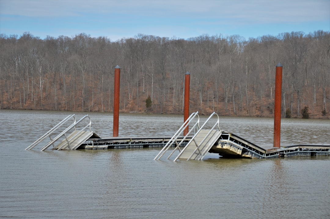
Perhaps one of the most insidious threats to levee stability is seepage and underseepage. When river levels rise significantly, a hydraulic head is created, forcing water to flow through the porous levee material (seepage) or beneath the levee foundation (underseepage). This constant flow of water can erode fine soil particles from within the levee, a process known as “piping.” As piping channels grow, they can weaken the levee’s internal structure, leading to a sudden loss of support and eventual breach. Underseepage can also cause “sand boils” to emerge on the landward side of the levee, indicating that water is actively eroding the underlying soil layers, a clear precursor to potential failure.
Erosion and Scour
The relentless erosive power of the Mississippi River itself poses a continuous threat to the levee system. High-velocity currents, particularly during flood stages, can directly attack the bankline adjacent to the levee. Scour, the removal of sediment from the riverbed and banks, can undermine the levee’s foundation, creating unstable conditions. This erosion can be exacerbated by increased navigation traffic, which can generate powerful wake waves that batter the levee’s slopes. Regular monitoring and strategic bank protection measures, such as riprap and revetments, are essential to mitigate the effects of erosion.
The Specter of Climate Change and Increased Flood Risk
The very environment that the levee system seeks to control is undergoing fundamental shifts due to climate change, presenting an amplified threat to its long-term viability. The historical flood patterns upon which the system was designed are being altered, challenging its fundamental protective capacity.
More Frequent and Intense Precipitation Events
Climate models consistently predict an increase in the frequency and intensity of extreme precipitation events across the Mississippi River Basin. Warmer atmospheric temperatures allow the air to hold more moisture, leading to “atmospheric rivers” that can dump unprecedented amounts of rain over vast areas. This increased rainfall translates directly into higher river flows and greater flood volumes entering the Mississippi River. The levees, designed for historical flood magnitudes, may find themselves overwhelmed by these “new normal” events.
Altered Hydrological Regimes
Beyond simply more rain, climate change is altering the entire hydrological regime of the basin. This includes shifts in snowmelt patterns, earlier spring thaws, and changes in the timing and duration of peak flows. The complex interaction of these factors means that flood events may become less predictable, with longer durations and higher crests. The levee system, a static infrastructure, is inherently less adaptable to such dynamic and evolving hydrological conditions. The analogy here is a dam designed for a gentle stream now facing a raging torrent.
Compound Flooding and Sea Level Rise
In the lower reaches of the Mississippi River, particularly in coastal Louisiana, the threat of riverine flooding is compounded by the effects of sea level rise and increased storm surge from hurricanes. As coastal lands subside and sea levels rise, the backwater effect of the Gulf of Mexico pushes further upstream, hindering the natural drainage of the river. This “compound flooding” creates a scenario where high river stages combine with elevated sea levels, putting immense pressure on the levees and coastal ecosystems alike. The levee system, while primarily designed for riverine flood control, is increasingly intertwined with coastal protection challenges.
Overlapping Critical Infrastructure and Cascading Failures
The failure of the Mississippi River Levee System would not be an isolated incident. Instead, it would unleash a cascade of failures across interconnected critical infrastructure, with far-reaching consequences that extend well beyond the immediate floodplains. The region protected by the levees is a vital nexus of national and international commerce.
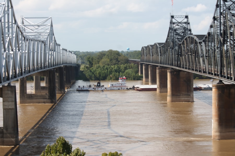
Impact on Transportation Networks
A levee breach would paralyze transportation networks. Major Interstate highways (e.g., I-10, I-55), mainline freight rail corridors, and vital pipelines that crisscross the Mississippi Valley would be submerged and rendered inoperable. This disruption would sever critical supply chains, impacting the movement of goods, agricultural products, and energy resources across the country. The economic ripple effects, akin to throwing a stone into a still pond, would be felt nationwide, leading to shortages, price spikes, and significant economic losses.
Disruptions to Energy Infrastructure
The Gulf Coast region is a hub for national energy infrastructure, including oil and gas pipelines, refineries, and chemical plants. Flooding from a levee failure would inundate these facilities, leading to widespread power outages, environmental contamination, and disruptions to fuel supplies. The shut down of even a few major refineries could severely impact energy markets, creating a national crisis. The risk of hazardous material spills would also be immense, as submerged facilities could release pollutants into the floodwaters, posing severe ecological and public health threats.
Agricultural Devastation and Economic Losses
The Mississippi River Alluvial Plain is one of the most agriculturally productive regions in the world, often referred to as the “breadbasket” of the nation. Levee failures would submerge millions of acres of prime farmland, leading to widespread crop destruction and long-term soil degradation. The economic losses for farmers, coupled with the disruption to the national food supply, would be catastrophic. The recovery effort would be protracted and immensely costly, affecting not only agricultural producers but also the wider agro-food industry and consumers.
The recent discussions surrounding the Mississippi River levee system failure have highlighted the critical need for infrastructure improvements and better flood management strategies. For a deeper understanding of the challenges faced by this vital system, you can read an insightful article that explores the historical context and current issues affecting the levees. This article provides valuable information on the implications of such failures and the ongoing efforts to enhance resilience. To learn more, visit this article for a comprehensive overview.
The Conundrum of Maintenance, Funding, and Future Adaptation
| Metric | Value | Description |
|---|---|---|
| Length of Levee System | 3,500 miles | Total length of levees along the Mississippi River |
| Number of Levee Failures | Over 100 | Documented levee breaches during major flood events |
| Maximum Flood Stage | 48 feet | Highest recorded river height during major floods |
| Year of Major Failure | 1927 | Year of the Great Mississippi Flood causing widespread levee failures |
| Area Flooded | 27,000 square miles | Land area inundated during the 1927 flood |
| Population Displaced | 600,000 people | Number of people forced to evacuate due to levee failures |
| Levee Height | Up to 30 feet | Typical height of levees along the river |
| Levee Maintenance Budget | Varies annually | Federal and state funding allocated for levee upkeep |
| Flood Control Structures | 29 major structures | Number of flood control dams and spillways in the system |
The looming disaster is not solely a matter of engineering defects or environmental shifts; it is also profoundly influenced by the political and economic landscape surrounding the levee system. The immense scale, age, and evolving risks require a proportional commitment to maintenance, funding, and innovative adaptation.
Deferred Maintenance and Aging Infrastructure
Like any large infrastructure project, the Mississippi River Levee System requires continuous inspection, repair, and upgrades. However, decades of underfunding and deferred maintenance have left significant portions of the system in a state of disrepair. From aged pump stations and deteriorating floodwalls to settling levee sections and outdated control structures, the cumulative effect of postponed repairs contributes significantly to overall system vulnerability. The adage “a stitch in time saves nine” could not be more apt for this critical infrastructure. Addressing this backlog requires sustained capital investment rather than reactive, emergency allocations.
Funding Challenges and Political Will
Securing adequate and consistent funding for the maintenance and improvement of such a vast system is a perennial challenge. The cost of upgrading and maintaining thousands of miles of levees, especially in the face of escalating climate risks, runs into the billions of dollars annually. This financial burden is often caught in the crosscurrents of political priorities, budgetary constraints, and the fragmented nature of federal and state responsibilities. The necessary political will to commit long-term, substantial funding – rather than relying on stop-gap measures and disaster relief – is crucial for safeguarding the future. Without this commitment, the system will continue to age and degrade, slowly but surely, towards a breaking point.
Adaptive Strategies and “Living with Water” Approaches
Recognizing that simply building higher and stronger levees may no longer be a sustainable or entirely effective strategy, there is a growing movement towards more adaptive approaches, often termed “living with water.” This paradigm shift involves a multi-faceted strategy that complements traditional flood control with ecosystem restoration, floodplain reconnection, and managed retreat in certain areas. Examples include creating dedicated floodways to divert excess water, restoring wetlands to naturally absorb floodwaters, and elevating structures in vulnerable areas. These approaches represent a move away from absolute control and towards a more nuanced coexistence with the river’s ecological processes, acknowledging its inherent power. Embracing these strategies requires a fundamental re-evaluation of land use policies and a broader public understanding of acceptable risk.
In conclusion, the Mississippi River Levee System, a bulwark against nature’s fury for generations, stands at a critical juncture. Its vulnerabilities, borne from historical design limitations, geotechnical challenges, and the undeniable acceleration of climate change, collectively paint a sobering picture. The potential for cascading failures across transportation, energy, and agricultural sectors underscores the immense national and international implications of a major breach. Addressing this looming disaster requires more than just engineering solutions; it demands a sustained, visionary commitment of resources, political will, and an embrace of innovative, adaptive strategies to ensure the protection and prosperity of the communities and ecosystems intertwined with this magnificent, yet formidable, river. The consequences of inaction weigh heavily on the scales of our collective future.
WATCH THIS! 🚨CRACKING: Why America’s $5 Trillion Dam is Failing Right Now
FAQs
What is the Mississippi River levee system?
The Mississippi River levee system is a network of embankments and floodwalls constructed along the Mississippi River to prevent flooding of adjacent lands, protect communities, and support navigation and agriculture.
Why are levees important along the Mississippi River?
Levees are crucial for controlling floodwaters, protecting populated areas, agricultural lands, and infrastructure from flooding, and maintaining the river’s navigability for commerce and transportation.
What causes levee system failures along the Mississippi River?
Levee failures can be caused by overtopping due to high water levels, structural weaknesses, erosion, seepage, poor maintenance, or extreme weather events such as heavy rainfall and storms.
What are the consequences of a Mississippi River levee failure?
Levee failures can lead to widespread flooding, property damage, loss of life, disruption of transportation and commerce, environmental damage, and long-term economic impacts on affected communities.
How is the Mississippi River levee system maintained and monitored?
The levee system is maintained and monitored by federal, state, and local agencies, including the U.S. Army Corps of Engineers, through regular inspections, repairs, upgrades, and the use of monitoring technology to detect potential weaknesses.
Have there been significant historical levee failures on the Mississippi River?
Yes, notable levee failures have occurred, such as during the Great Mississippi Flood of 1927 and the 2011 Mississippi River floods, which caused extensive damage and prompted improvements in flood control infrastructure.
What measures are taken to prevent future levee failures?
Preventive measures include strengthening and raising levees, improving drainage systems, implementing floodplain management practices, investing in early warning systems, and restoring natural flood buffers like wetlands.
Who is responsible for responding to levee failures along the Mississippi River?
Emergency response involves coordination among local, state, and federal agencies, including the U.S. Army Corps of Engineers, FEMA, state emergency management offices, and local authorities to manage evacuations, repairs, and recovery efforts.
Can levee failures be predicted or prevented entirely?
While levee failures cannot be completely prevented, risk can be minimized through proper design, maintenance, monitoring, and emergency preparedness. Predictive models and real-time monitoring help provide early warnings to reduce impacts.
How does climate change affect the Mississippi River levee system?
Climate change can increase the frequency and severity of extreme weather events, such as heavy rainfall and storms, leading to higher flood risks and greater stress on the levee system, necessitating adaptive management and infrastructure upgrades.