The Atchafalaya River Diversion and its associated floodway system represent one of the most critical feats of hydraulic engineering in the United States, designed to manage the immense power and sediment load of the Mississippi River. This complex system, a direct consequence of the river’s geomorphological tendencies and human intervention, acts as a crucial safety valve, mitigating catastrophic flooding in the lower Mississippi Valley and safeguarding vital economic and ecological interests. Its ongoing management involves a perpetual balancing act between hydrological necessity, environmental preservation, and human habitation, a challenge that consistently demands foresight, adaptation, and extensive resource commitment.
The Mississippi River, a dendritic system draining over 40% of the contiguous United States, carries an enormous volume of water and sediment. Historically, this river has been a restless giant, naturally seeking the shortest and steepest path to the sea. For millennia, its primary outlet oscillated between what is now the modern-day Mississippi River course and the Atchafalaya Basin. This natural process, known as avulsion, sees the river abandon its established channel for a new, steeper course, often with devastating consequences for existing human settlements. The recent developments in the Mississippi River infrastructure have significantly improved transportation and trade efficiency.
Historical Avulsion Events
Understanding the Atchafalaya Diversion requires acknowledging the Mississippi’s historical patterns. Geoscientists have extensively documented numerous past avulsion events, where the river’s main stem shifted dramatically. These events were not instantaneous but rather gradual processes, often spanning decades or even centuries, during which a distributary slowly captured more and more of the main flow. The current course of the Mississippi, culminating at New Orleans, is itself a recent geological phenomenon, having captured the flow from earlier, more westerly courses.
The Rise of Concern in the 20th Century
By the early 20th century, engineers observed a clear and concerning trend: the Atchafalaya River, a significant distributary of the Mississippi, was steadily enlarging and deepening its channel. The shorter, steeper gradient of the Atchafalaya offered a more efficient route for the river’s waters to reach the Gulf of Mexico compared to the meandering path of the main Mississippi channel downstream of the Old River confluence. This natural capture process threatened to divert the overwhelming majority of the Mississippi’s flow into the Atchafalaya, bypassing Baton Rouge and New Orleans entirely. Such an event would have rendered these major port cities and their associated infrastructure, including industrial complexes and vital navigation channels, effectively landlocked or drastically reduced in functionality, leading to an economic catastrophe of unprecedented scale.
The Atchafalaya River diversion poses significant risks to both the environment and local communities, as highlighted in a related article discussing the potential impacts of such diversions on sediment flow and ecosystem health. For a deeper understanding of these issues, you can read more about it in this article on MyGeoQuest: MyGeoQuest.
The Old River Control Structure: A Monument to Hydraulic Engineering
The impending avulsion necessitated a bold and unprecedented engineering response: the construction of the Old River Control Structure (ORCS). Authorized by the Flood Control Act of 1954, the ORCS was designed not to stop the flow of the Atchafalaya but to regulate it, ensuring a prescribed distribution of the Mississippi’s discharge between its two major outlets. This regulatory mandate became a cornerstone of flood control policy in the lower Mississippi.
Design and Construction of the ORCS
The ORCS complex, located near the confluence of the Mississippi, Red, and Atchafalaya Rivers, is a marvel of hydraulic engineering. It comprises several key components:
- The Low-Sill Structure: This initial component, completed in 1963, is a concrete weir with gates designed to pass a controlled amount of flow into the Red River and then into the Atchafalaya. Its primary purpose is to skim off a predetermined percentage of the Mississippi’s flow.
- The Overbank Structure: Recognising the limitations of the Low-Sill during extreme flood events, the Overbank Structure, completed in 1959, was built on higher ground to pass additional flow when the Mississippi reaches higher stages. It provides an essential complementary capacity during peak flood events.
- The Auxiliary Structure: Following concerns regarding the stability of the Low-Sill during the monumental 1973 flood, where significant scour threatened the structure’s foundations, the Auxiliary Structure was constructed. Completed in 1986, this structure acts as an additional flow-regulating mechanism, providing redundancy and increased capacity, particularly during high-water events. It acts as a crucial backstop, reducing the hydraulic stresses on the Low-Sill.
The 70%-30% Rule
The operational directive for the ORCS is codified in the “70%-30% rule.” This critical regulation mandates that approximately 30% of the combined flow of the Mississippi and Red Rivers be diverted into the Atchafalaya River, with the remaining 70% continuing down the main Mississippi channel. This proportion was determined based on a complex interplay of historical flow patterns, hydrological modeling, and the need to maintain sufficient flow for navigation and environmental health in both basins. The constant monitoring and precise adjustment of the ORCS gates to adhere to this rule are continuous responsibilities of the U.S. Army Corps of Engineers (USACE).
The Atchafalaya Floodway System: A Controlled Release Valve
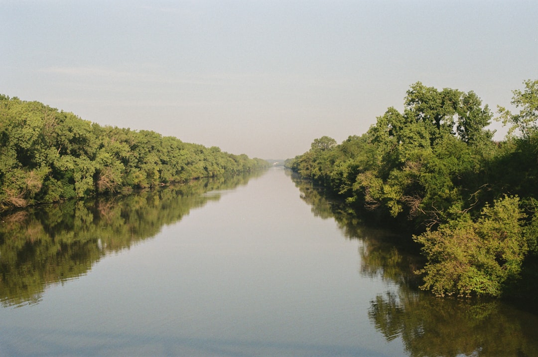
Beyond the ORCS, the Atchafalaya Basin itself forms an integral part of the flood control strategy, acting as a massive natural overflow basin and floodway system. This basin, a sprawling expanse of swamps, bayous, and bottomland hardwoods, is roughly 150 miles long and 20 miles wide, representing the largest river swamp in North America. Its intrinsic capacity to absorb and convey floodwaters is a bulwark against widespread inundation.
The Morganza Spillway
A critical component of the Atchafalaya Floodway system is the Morganza Spillway, located upstream of Baton Rouge on the west bank of the Mississippi River. Constructed as an emergency overflow structure, the Morganza Spillway is designed to divert a significant portion of Mississippi River floodwaters directly into the Atchafalaya Basin when the main river channel is at dangerously high stages.
- Triggering Conditions and Operation: The decision to open the Morganza Spillway is momentous, made only under conditions of extreme hydraulic stress on the main levee system. It is a last resort measure, enacted to prevent catastrophic levee failures along the lower Mississippi, which would indiscriminately flood densely populated areas. The opening involves the controlled lowering of massive gates, allowing floodwaters to surge into the relatively undeveloped upper Atchafalaya Basin.
- Consequences of Activation: While essential for flood control, the activation of the Morganza Spillway carries significant consequences. It deliberately inundates agricultural lands, disrupts local transportation, and can temporarily impact the hydrology and ecology of the Atchafalaya Basin. These impacts are carefully weighed against the potentially far greater devastation of a levee breach along the main stem.
The West Atchafalaya Bay Protection Levee
Further downstream, at the mouth of the Atchafalaya River, the West Atchafalaya Bay Protection Levee is an environmental and engineering feature. While not directly a flood control structure in the same sense as the ORCS or Morganza, it plays a role in managing sediment deposition and supporting deltaic growth. Its primary purpose was to guide the sediment-laden waters to specific areas to build new land in the Atchafalaya Bay, a critical process for coastal restoration in Louisiana. It helps reduce widespread sediment distribution, focusing it to a specific area to help build new delta lobes.
Environmental and Ecological Impacts: A Double-Edged Sword
While designed to prevent human and economic catastrophe, the Atchafalaya River Diversion and its associated structures have profound environmental and ecological implications, presenting a complex challenge for resource managers. The intervention directly alters the natural hydrology of a vast estuarine and riverine system.
Changes to Sediment and Nutrient Distribution
Historically, the Mississippi River broadly distributed its sediment and nutrients across a vast deltaic plain, replenishing wetlands and building new land. The ORCS and the levee systems, however, largely confine the Mississippi’s sediment load to specific pathways. The 30% diversion into the Atchafalaya means that this basin receives a disproportionately large share of the river’s total sediment and nutrient load.
- Atchafalaya Basin Sedimentation: This increased sediment delivery has led to rapid land-building in the Atchafalaya Delta, expanding the basin’s landmass into the Gulf of Mexico. While beneficial for coastal restoration in this specific area, it also contributes to rapid shoaling within the basin itself, impacting navigation and altering wetland ecosystems by changing water depths and flow patterns.
- Main Stem Sediment Deprivation: Conversely, the lower Mississippi River, south of the ORCS, is largely starved of its historical sediment supply. This sediment starvation exacerbates coastal erosion and subsidence in other parts of Louisiana’s deltaic plain, as natural land-building processes are diminished. The balancing act requires engineers to weigh the benefits of land building in one area against long-term deterioration in others.
Altered Hydrodynamics and Ecosystem Function
The regulated flow, confined floodways, and altered sediment regimes dramatically change the hydrodynamics and ecological function of both the Mississippi and Atchafalaya systems.
- Impact on Fisheries and Wildlife: The Atchafalaya Basin supports an incredibly rich tapestry of aquatic and terrestrial life, including significant commercial and recreational fisheries. Alterations in water levels, flow regimes, and nutrient concentrations can affect habitat availability, reproductive cycles, and species composition. For instance, the timing and duration of inundation, now artificially controlled, can impact the spawning success of various fish species.
- Salinity Intrusion into the Mississippi: By maintaining a greater average freshwater flow in the main stem Mississippi, the ORCS helps push back the saltwater wedge that naturally intrudes upriver from the Gulf. This is crucial for protecting municipal and industrial freshwater intakes, particularly during periods of low flow. Without the diversion, greater volumes of freshwater might be lost to the Atchafalaya, making the Mississippi more vulnerable to salinity intrusion. This demonstrates the intricate interconnectedness of the system and the multiple benefits of controlled flow.
The Atchafalaya River diversion poses significant risks to both the surrounding ecosystems and local communities, making it a topic of great concern for environmentalists and policymakers alike. For a deeper understanding of the implications of this diversion, you can explore a related article that discusses the potential impacts on wildlife and water quality. This insightful piece can be found here, providing valuable information for those interested in the ongoing debates surrounding river management and conservation efforts.
Future Challenges and Adaptive Management
| Metric | Description | Value | Unit | Source/Notes |
|---|---|---|---|---|
| Annual Flood Risk Probability | Likelihood of flooding due to river diversion | 12 | % | Estimated based on historical flood data |
| Maximum Flow Rate | Peak water flow through the diversion structure | 250,000 | cfs (cubic feet per second) | Measured during high water events |
| Sediment Load | Amount of sediment transported by the river | 1,200 | tons/day | Average during diversion operation |
| Land Loss Rate | Rate of wetland loss due to diversion impacts | 0.5 | acres/year | Based on recent environmental studies |
| Water Quality Index | Overall water quality rating downstream | 72 | Index (0-100) | Measured annually |
| Economic Impact | Estimated economic loss from diversion-related risks | 15,000,000 | USD | Annual average estimate |
Managing the Atchafalaya Diversion is not a static endeavor but an ongoing challenge. Climate change, evolving land-use practices, and the relentless forces of nature demand continuous monitoring, adaptation, and significant investment to maintain the system’s efficacy and resilience.
Climate Change and Increased Flood Severity
Projections of climate change frequently indicate an increase in the frequency and intensity of extreme weather events, including heavier rainfall in the Mississippi River watershed. This translates to a higher probability of more severe and prolonged flood events on the Mississippi River.
- Increased Stress on Infrastructure: Greater flood peaks will place unprecedented stresses on the ORCS, the Morganza Spillway, and the entire levee system. This necessitates ongoing inspection, maintenance, and potential structural enhancements to ensure these critical infrastructures can withstand future hydraulic loads. The margin of error allowed by current design capacities will be increasingly tested, demanding robust solutions.
- Dilemma of Spillway Activation: More frequent severe floods will also increase the likelihood of needing to activate the Morganza Spillway. This presents a complex dilemma, balancing the need to protect major metropolitan areas with the impacts on the Atchafalaya Basin and its communities, requiring careful consideration of trade-offs. The decision will increasingly be a question of which areas are least critical to flood.
Sediment Management Strategies
The problem of sediment deprivation in parts of the delta and excessive sedimentation in others remains a critical challenge. Future management strategies must address how to more effectively utilize the substantial sediment load carried by the Mississippi River.
- Diversions for Coastal Restoration: There is growing interest in developing additional sediment diversions along the lower Mississippi, specifically designed to funnel sediment-laden water into degrading coastal wetlands. These projects, while technically complex and expensive, offer a potential pathway to rebuild land and fortify Louisiana’s vulnerable coastline against rising sea levels and subsidence. The success of such projects hinges on detailed hydrological modeling and ecological considerations.
- Navigational Dredging Challenges: The ongoing need for navigational dredging in both the Mississippi and Atchafalaya Rivers to maintain shipping channels is directly tied to sediment load. Strategic placement of dredged material, rather than simple disposal, offers opportunities for habitat creation and wetland nourishment. This transforms a cost into an environmental benefit.
Long-Term Sustainability and Community Engagement
The long-term sustainability of the Atchafalaya Diversion strategy hinges not only on engineering solutions but also on robust political will, adequate funding, and effective community engagement.
- Funding and Maintenance: The scale of the infrastructure and the continuous threat from the river necessitate substantial and consistent funding for maintenance, repairs, and upgrades. Deterioration of critical components due to underinvestment could lead to catastrophic failures. This is not a project that can ever be considered “finished.”
- Stakeholder Collaboration: Given the diverse impacts of the diversion on navigation, agriculture, fisheries, and environmental health, effective management requires continuous collaboration between federal agencies (primarily USACE), state governments, local communities, environmental groups, and industry stakeholders. Transparent communication and participatory decision-making processes are crucial for navigating the complex trade-offs inherent in this monumental river management effort. This includes engaging with those directly affected by flood events and those whose livelihoods depend on the river’s regulated flow.
In conclusion, the Atchafalaya River Diversion and its intricate system of control structures and floodways represent a profound human effort to master the formidable power of one of the world’s great rivers. This triumph of engineering has safeguarded economic centers and protected millions from the ravages of uncontrolled flooding. However, it is an ever-evolving narrative, demanding perpetual vigilance, adaptation to a changing climate, and a nuanced understanding of its complex environmental and social implications. The Atchafalaya remains a living testament to humanity’s capacity to shape its environment, but also a stark reminder of the enduring power of nature and the need for humility and foresight in its management.
WATCH THIS! 🚨CRACKING: Why America’s $5 Trillion Dam is Failing Right Now
FAQs
What is the Atchafalaya River Diversion?
The Atchafalaya River Diversion is a flood control project designed to divert water from the Mississippi River into the Atchafalaya Basin in Louisiana. Its purpose is to reduce flood risk along the Mississippi River and manage water flow between the two river systems.
Why is the Atchafalaya River Diversion considered a risk?
The diversion poses risks because it can alter natural water flow patterns, potentially leading to increased flooding, sediment deposition, and ecological changes in the Atchafalaya Basin. There is also concern that the diversion could accelerate the natural capture of the Mississippi River by the Atchafalaya River, impacting navigation and local communities.
How does the diversion affect flood control efforts?
The diversion helps to relieve pressure on the Mississippi River during high water events by channeling excess flow into the Atchafalaya Basin. However, if not properly managed, it can increase flood risk in the Atchafalaya region and surrounding areas.
What environmental impacts are associated with the Atchafalaya River Diversion?
Environmental impacts include changes to wetland ecosystems, alterations in sediment transport, and potential harm to fish and wildlife habitats. The diversion can also influence water quality and the natural hydrology of the basin.
Who manages the Atchafalaya River Diversion?
The U.S. Army Corps of Engineers is primarily responsible for managing the Atchafalaya River Diversion as part of the Mississippi River and Tributaries flood control system.
Are there ongoing efforts to mitigate the risks of the diversion?
Yes, ongoing monitoring, engineering improvements, and environmental restoration projects aim to balance flood control benefits with minimizing ecological and community risks associated with the diversion.
Can the Atchafalaya River Diversion impact local communities?
Yes, changes in water flow and flooding patterns can affect local communities through property damage, changes in land use, and impacts on fisheries and recreation.
Is the Atchafalaya River Diversion a permanent structure?
The diversion includes permanent infrastructure such as control structures and levees, but its operation is managed dynamically based on river conditions and flood risk assessments.