The Mississippi River, a central artery of North American commerce, presents mariners with a complex and ever-changing environment. Understanding its channel depth is paramount for safe navigation, economic viability, and the strategic planning of vessel movements. This article delves into the intricacies of Mississippi River channel depths, providing a factual overview of their management, measurement, and implications.
The recent developments in the Mississippi River infrastructure have significantly improved transportation and trade efficiency.
The Mississippi River’s role as a transportation corridor predates European colonization, with indigenous peoples utilizing its waters for trade and travel for millennia. The advent of steam-powered vessels in the 19th century dramatically increased riverine traffic, necessitating a more systematic approach to channel maintenance.
Early Challenges and Congressional Action
- Snags and Shoals: Early navigators faced constant perils from submerged trees (snags) and shifting sandbars, which frequently grounded vessels and caused significant delays.
- Congressional Mandate: Recognizing the river’s economic importance, the U.S. Congress began allocating funds for river improvement projects in the early 19th century. The Rivers and Harbors Act of 1884 solidified the commitment to maintaining a navigable channel.
The Role of the U.S. Army Corps of Engineers (USACE)
Established in 1802, the USACE became the primary federal agency responsible for developing and maintaining the nation’s water resources infrastructure. Its involvement with the Mississippi River has been extensive and continuous.
- Channelization Efforts: Early USACE initiatives focused on dredging, revetments, and the construction of wing dams to confine the river’s flow and scour a deeper channel.
- Flood Control: Beyond navigation, the USACE also plays a critical role in managing flood risks along the Mississippi, a function intrinsically linked to channel dynamics.
The Mississippi River plays a crucial role in the transportation of goods across the United States, and understanding its navigation channel depth is essential for maintaining efficient shipping routes. For more insights on this topic, you can refer to a related article that discusses the challenges and developments in river navigation. To read more, visit this article.
Methods of Channel Depth Measurement and Maintenance
Maintaining a navigable channel depth on a dynamic river like the Mississippi is a continuous and resource-intensive undertaking. It involves a combination of sophisticated technologies and robust engineering practices.
Hydrographic Surveying Techniques
Accurate and timely data on channel depths are crucial for safe navigation. The USACE employs a variety of hydrographic surveying methods.
- Single-Beam Echosounding: This traditional method uses a transducer to emit a sound pulse and measure the time it takes for the echo to return from the riverbed. It provides depth measurements directly below the vessel.
- Multibeam Echosounding (MBES): A more advanced technique, MBES systems emit multiple sound pulses in a fan-shaped pattern, collecting data from a wider swath of the riverbed with each pass. This provides a more comprehensive and detailed bathymetric map.
- Lidar (Light Detection and Ranging): While primarily used for topographic mapping, airborne lidar can also be used in clear, shallow waters to map the riverbed, especially in areas where traditional echosounding might be less efficient.
Dredging Operations
Dredging is the primary method for deepening and widening navigation channels. It involves excavating material from the riverbed and depositing it elsewhere.
- Dredge Types: Various types of dredges are utilized, including cutterhead dredges, which mechanically excavate material, and hopper dredges, which scoop up sediment and carry it to a disposal site.
- Maintenance Dredging: This ongoing process removes naturally accumulating sediment that reduces channel depth. It is a constant battle against the river’s relentless depositional forces.
- Capital Dredging: Less frequent, capital dredging projects aim to deepen or widen existing channels to accommodate larger vessels or to establish new navigation routes.
River Training Structures
Beyond dredging, the USACE employs various river training structures to influence the river’s flow and shape its channel. These structures act as the river’s sculptors, guiding its erosive and depositional tendencies.
- Revetments: These armored bank protections, often made of articulated concrete mats, prevent erosion and stabilize the riverbanks, helping to maintain channel alignment.
- Dikes and Sills: Submerged or partially submerged structures that project into the channel, dikes (also known as wing dams or groins) constrict the flow, increasing its velocity and promoting scour to deepen the channel. Sills are similar but typically run perpendicular to the flow.
- Locks and Dams: While primarily for creating stairstep navigation pools, locks and dams also stabilize upstream water levels and contribute to predictable channel depths within their respective pools.
The “Design Channel” and Its Realities
The concept of a “design channel” is central to Mississippi River navigation. This refers to the depth and width that the USACE aims to maintain for commercial traffic.
Authorized Depths and Practical Depths
- Lower Mississippi River (Baton Rouge to the Gulf): The authorized design channel for this critical segment is typically 45 feet (13.7 meters) for the full navigation channel, with plans to deepen it to 50 feet (15.2 meters) in certain sections. This depth accommodates deep-draft ocean-going vessels.
- Upper Mississippi River (Minneapolis to Cairo): The authorized design channel for the Upper Mississippi is generally 9 feet (2.7 meters). This significantly shallower depth dictates the types of vessels and cargo that can operate on this segment.
- Practical Depth Variability: While authorized depths serve as targets, the actual navigable depth can fluctuate due to a multitude of factors, including naturally occurring high water and low water periods, recent flood events, and the effectiveness of maintenance dredging. Mariners must always refer to current hydrographic surveys and notice to mariners for real-time conditions.
Factors Influencing Actual Channel Depths
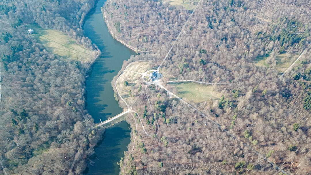
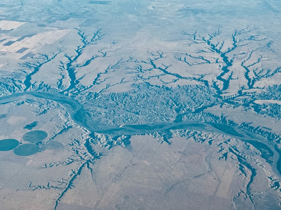
The Mississippi River is a living entity, constantly shifting and reshaping its course. This dynamism directly impacts channel depths.
- Sedimentation: The river carries immense quantities of sediment, which continually settle in slower-moving areas, particularly in bends and behind obstructions, leading to shoaling.
- High Water Events: While high water provides greater total depth, it can also lead to increased sediment transport and deposition in unexpected areas as floodwaters recede. Additionally, strong currents associated with high water can make navigation challenging or even impossible for certain vessel types.
- Low Water Periods: During extended droughts, river levels can drop dramatically, reducing available channel depths and often triggering emergency dredging operations. These periods can severely restrict vessel drafts, leading to lighter loads and increased transportation costs.
- River Morphodynamics: The river’s natural tendency to meander, erode banks, and deposit sediment is a constant force shaping the channel. The USACE’s efforts are essentially a continuous negotiation with these natural processes.
Navigational Tools and Information for Seafarers
For mariners navigating the Mississippi, access to accurate and timely information on channel depths is not merely advisable; it is a fundamental requirement for safe and efficient operations. Ignoring this information is akin to sailing blindly into a fog.
Notices to Mariners and Hydrographic Surveys
- USACE Notices: The USACE regularly issues “Notices to Mariners” (NTMs) that provide critical updates on channel conditions, including shoaling areas, dredging operations, navigation hazards, and changes to aids to navigation. These are distributed electronically and are essential reading for all navigators.
- Hydrographic Survey Reports: Detailed hydrographic surveys, often accompanied by bathymetric charts, provide granular depth information for specific reaches of the river. These are updated frequently, especially in areas prone to rapid change.
Electronic Chart Display and Information Systems (ECDIS)
Modern vessels increasingly rely on ECDIS, which integrates electronic navigational charts (ENCs) with real-time positioning information.
- ENC Integration: ENCs display depths, aids to navigation, and other relevant information. They can be updated electronically with new survey data, providing mariners with the most current representation of the channel.
- Depth Alarms: ECDIS allows mariners to set depth alarms, which trigger if the vessel approaches an area shallower than a predetermined safe draft, thereby providing a crucial layer of safety. This digital guardian acts as a continuous lookout for hidden dangers.
Draft Management and Load Optimization
Effective management of vessel draft is paramount, especially when navigating segments with fluctuating depths.
- Load Calculations: Vessel operators meticulously calculate optimal loading strategies, considering the forecasted channel depths and the vessel’s maximum permissible draft for a given journey. This often means “light loading” during low-water periods, carrying less cargo to maintain a safe under-keel clearance.
- Under-Keel Clearance (UKC): Maintaining adequate UKC is a non-negotiable safety principle. It accounts for potential inaccuracies in depth measurements, the vessel’s squat (the tendency of a moving vessel to settle deeper in the water), and the dynamic nature of the riverbed. A prudent mariner always builds in a safety margin, considering the river as a capricious partner that might surprise.
The Mississippi River plays a crucial role in the transportation of goods across the United States, and understanding the navigation channel depth is essential for maintaining efficient shipping routes. A related article discusses the ongoing efforts to manage and improve the river’s navigability, highlighting the importance of regular dredging and infrastructure upgrades. For more insights on this topic, you can read the article on Mississippi River navigation. This information is vital for industries relying on this major waterway for commerce and trade.
Economic and Environmental Implications of Channel Depths
| Location | Navigation Channel Depth (feet) | Year Last Dredged | Maintaining Authority | Notes |
|---|---|---|---|---|
| Upper Mississippi River (St. Paul to St. Louis) | 9 | 2023 | U.S. Army Corps of Engineers | Maintained for barge traffic and commercial navigation |
| Lower Mississippi River (St. Louis to Gulf of Mexico) | 45 | 2022 | U.S. Army Corps of Engineers | Deep draft navigation channel for ocean-going vessels |
| Mississippi River Gulf Outlet (MRGO) | 40 | 2021 | U.S. Army Corps of Engineers | Channel depth maintained for shipping access to New Orleans |
| Mississippi River – Baton Rouge to New Orleans | 40 | 2023 | U.S. Army Corps of Engineers | Key commercial navigation segment |
The depth of the Mississippi River’s navigation channel has far-reaching consequences, impacting national economy, global trade, and the river’s ecological health. It is the river’s pulse, reflecting its economic vitality and environmental vulnerability.
Economic Impact on Agriculture and Industry
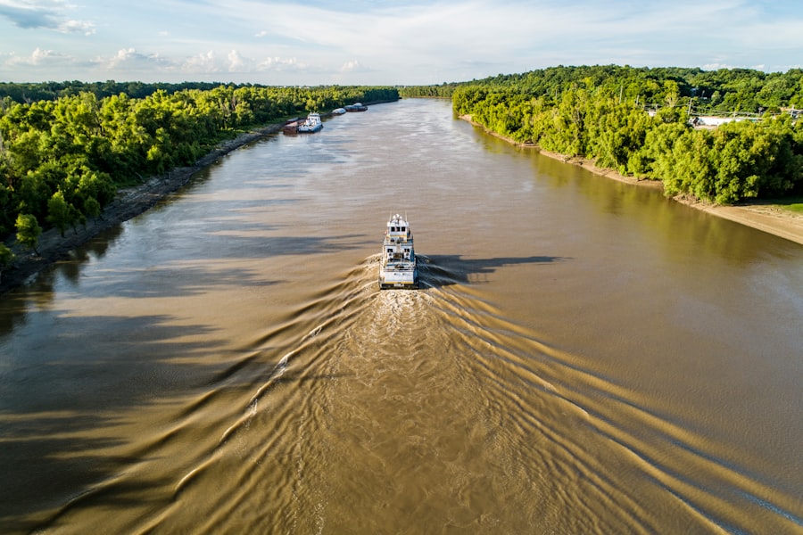
- Bulk Cargo Transportation: The Mississippi River serves as a vital conduit for the transportation of vast quantities of bulk commodities, including grain, coal, petroleum products, and chemicals. Deeper channels allow for larger barges and tow sizes, reducing per-ton transportation costs.
- Global Competitiveness: For agricultural exports, especially from the Midwest, consistent channel depths are critical for maintaining the competitiveness of U.S. produce in international markets. Restrictions on draft can lead to significant delays and increase costs, making American goods less attractive.
- Port Activity: The port complexes along the Lower Mississippi, such as New Orleans and South Louisiana, are among the busiest in the world. Their ability to handle deep-draft vessels is directly tied to the maintained channel depths from the Gulf to Baton Rouge.
Environmental Considerations of Dredging and River Training
While essential for navigation, channel maintenance activities also carry environmental implications that require careful management.
- Habitat Disruption: Dredging can temporarily disturb benthic habitats and impact aquatic species. Care must be taken to minimize these impacts, often through timing dredging operations to avoid critical spawning seasons.
- Sediment Disposal: The disposal of dredged material is a significant challenge. Environmentally sound disposal practices include beneficial uses, such as wetland creation or beach nourishment, which can offset some of the negative impacts.
- Ecosystem Alteration: River training structures, while effective for navigation, can alter natural riverine processes, affecting fish migration patterns, sediment distribution, and the overall ecological balance of the river. Balancing these needs is a perpetual challenge.
Future Challenges and Adaptations
The Mississippi River’s future navigation will be shaped by ongoing environmental changes and economic pressures.
- Climate Change: Increased frequency and intensity of extreme weather events, such as prolonged droughts and severe floods, pose significant challenges to maintaining consistent channel depths. The river will become an even more dynamic partner.
- Aging Infrastructure: The vast infrastructure of locks, dams, and revetments along the river requires continuous investment for maintenance and modernization.
- Technological Advancements: Continued advancements in hydrographic surveying, autonomous dredging technologies, and real-time data integration will be crucial for efficient and effective channel management in the years to come. The digital revolution is slowly but surely extending its reach even to the ancient flow of the Mississippi.
Navigating the Mississippi River is a testament to human ingenuity and perseverance in the face of nature’s relentless power. The consistent effort to maintain and understand its channel depths ensures that this majestic river continues to serve as a vital lifeline for commerce, connecting the heartland of America to the global economy. The partnership between mariners, engineers, and policymakers will remain essential as they collectively manage this crucial waterway in an ever-changing world.
WATCH THIS! 🚨CRACKING: Why America’s $5 Trillion Dam is Failing Right Now
FAQs
What is the current authorized depth of the Mississippi River navigation channel?
The authorized depth of the Mississippi River navigation channel varies by segment, but the main commercial navigation channel is generally maintained at a depth of 9 feet from Minneapolis, Minnesota, to the Gulf of Mexico. Certain sections, especially near major ports, may be deeper to accommodate larger vessels.
Why is maintaining the navigation channel depth important for the Mississippi River?
Maintaining the navigation channel depth is crucial for ensuring safe and efficient passage of commercial vessels, including barges and cargo ships. It supports the transportation of agricultural products, raw materials, and manufactured goods, which is vital for the regional and national economy.
Who is responsible for maintaining the Mississippi River navigation channel depth?
The U.S. Army Corps of Engineers is primarily responsible for maintaining the navigation channel depth on the Mississippi River. They conduct regular dredging and other maintenance activities to keep the channel navigable.
How often is dredging performed to maintain the channel depth?
Dredging frequency depends on sediment accumulation and river conditions but typically occurs annually or as needed. The U.S. Army Corps of Engineers monitors the channel and schedules dredging to ensure the authorized depth is maintained.
What challenges affect maintaining the Mississippi River navigation channel depth?
Challenges include sediment deposition, fluctuating water levels, weather events such as floods and droughts, and environmental regulations. These factors can complicate dredging operations and impact navigation safety.
Are there any plans to deepen the Mississippi River navigation channel?
There have been discussions and studies about deepening certain segments of the Mississippi River navigation channel to accommodate larger vessels and increase transportation efficiency. However, such projects require extensive environmental review, funding, and coordination among stakeholders.
How does the navigation channel depth impact commercial shipping on the Mississippi River?
The channel depth directly affects the size and load capacity of vessels that can safely navigate the river. Adequate depth allows for larger barges and ships, reducing transportation costs and increasing the volume of goods moved.
Can natural events like floods or droughts affect the navigation channel depth?
Yes, natural events such as floods can cause increased sediment movement and deposition, while droughts can lower water levels, both impacting the effective navigation depth and requiring adjustments in maintenance efforts.
Is the navigation channel depth uniform along the entire Mississippi River?
No, the authorized and maintained depth can vary along different sections of the river, depending on factors like river width, traffic volume, and proximity to ports. Some areas may have deeper channels to support specific commercial needs.
How does the Mississippi River navigation channel depth compare to other major U.S. inland waterways?
The Mississippi River’s 9-foot navigation channel is standard for many U.S. inland waterways, but some rivers and canals have deeper channels, such as the Illinois Waterway or the Ohio River, to accommodate different vessel sizes and traffic demands.