The Mississippi River, a colossal artery of commerce and culture, periodically demands exceptional measures to maintain its navigability. Emergency dredging operations represent a critical intervention in this perennial battle against siltation and sedimentation. These operations are not routine maintenance; they are reactive responses to acute hydrological events or sudden shoaling that imperil the flow of goods and the safety of navigation.
The Mississippi’s vast watershed, encompassing over 40% of the continental United States, acts as a prodigious conveyor belt for sediment. Each year, countless tons of sand, silt, and clay are transported downstream, relentlessly seeking their final resting place in the Gulf of Mexico. This natural process, while essential for ecosystem health and delta formation, poses a continuous challenge to human endeavors to keep the river open for transshipment. The recent developments in the Mississippi River infrastructure have significantly improved transportation and trade efficiency.
Understanding the River’s Dynamic Nature
The Mississippi is not a static entity; it is a living, breathing hydrological system, constantly reshaping its bed and banks. This dynamic nature is a double-edged sword: it creates fertile floodplains but also translates into unpredictable changes in channel depth and alignment.
- Flow Velocity and Sediment Transport: The velocity of the river’s current is the primary determinant of its sediment-carrying capacity. During periods of high flow, the river mobilizes larger quantities of sediment and can scour its bed. Conversely, as flow diminishes, the river’s energy dissipates, leading to deposition.
- Meanders and Point Bars: The sinuous course of the Mississippi, characterized by meanders, contributes significantly to sedimentation patterns. Sediment is often eroded from the outer bends (cut banks) and deposited on the inner bends (point bars), progressively shifting the channel.
- Tributary Influx: The confluence of major tributaries, such as the Ohio, Missouri, and Arkansas Rivers, introduces substantial sediment loads, especially after heavy rainfall events in their respective basins.
The Economic Imperative of a Navigable River
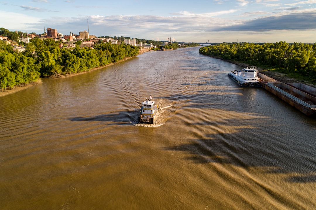
The economic impact of the Mississippi River as a navigable waterway is profound, supporting a vast network of industries from agriculture to energy. Its uninterrupted flow is paramount for domestic and international trade.
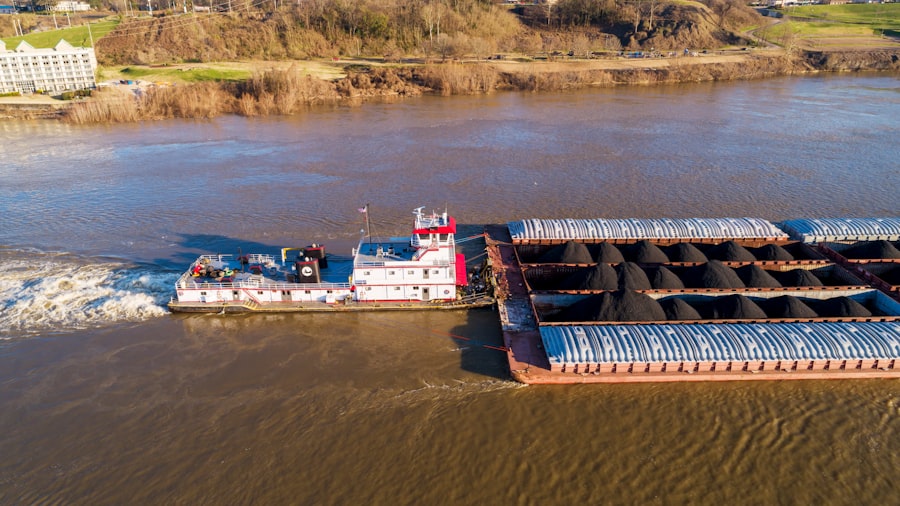
- Barge Transportation: Barges are the most cost-effective mode of transport for bulk commodities like grain, coal, petroleum products, and chemicals. A single barge can carry the equivalent of 15 jumbo rail cars or 60 large semi-trucks, making the river a vital logistical backbone.
- Agricultural Exports: The vast majority of American agricultural exports, particularly grains from the Midwest, reach international markets via the Mississippi River and the Port of New Orleans. Any disruption can have cascading effects on global food prices and supply chains.
- Industrial Supply Chains: Numerous industrial facilities along the river rely on the waterway for receiving raw materials and shipping finished products. An impediment to navigation can disrupt these supply chains, leading to production delays and economic losses.
Recent discussions surrounding the Mississippi River have highlighted the urgent need for emergency dredging operations to maintain navigability and prevent flooding. For a deeper understanding of the challenges and strategies involved in these operations, you can refer to a related article that provides insights into the ongoing efforts and environmental considerations. For more information, visit this article.
Triggers for Emergency Dredging: When Nature Intervenes
Emergency dredging is not a scheduled maintenance activity; it is a rapid response to unforeseen hydrological events or abrupt changes in the river’s morphology. These triggers are typically characterized by their sudden onset and significant impact on navigation.
Extreme Weather Events
Periods of intense rainfall, prolonged drought, or unusual flood cycles are frequent precursors to emergency dredging requirements. These events dramatically alter the river’s sediment dynamics.
- Major Floods: While floods initially scour shallow areas, as floodwaters recede, the sudden decrease in velocity can lead to massive deposition in previously deep channels. This phenomenon can create new shoals or exacerbate existing ones overnight.
- Extended Droughts: Conversely, prolonged droughts lead to significantly reduced water levels, exposing existing shoals that were previously submerged and navigable. The reduced flow also means less energy to transport sediment, allowing it to accumulate more readily.
- Hurricane Aftermath: Hurricanes affecting the Gulf Coast can cause significant storm surge upriver and contribute to increased sediment loads from exacerbated erosion in tributaries, particularly in the lower Mississippi.
Unforeseen Shoaling Events
Shoaling, the gradual accumulation of sediment, can sometimes occur unexpectedly and rapidly, necessitating immediate intervention. These events are often localized but can have widespread ripple effects.
- Sudden Bank Collapse: Erosion of riverbanks can introduce large volumes of sediment into the channel instantaneously, creating hazardous shoals. This can be triggered by strong currents, vessel wakes, or geological instability.
- Submerged Obstructions: While less common, the unexpected presence of large debris (e.g., fallen trees, sunken vessels) can alter flow patterns, leading to localized sediment accumulation and the formation of dangerous shoals.
- Anthropogenic Influences: While the river is primarily a natural system, human activities upstream, such as large-scale land-use changes or dam operations, can sometimes indirectly contribute to altered sediment regimes and localized shoaling further downstream.
The Unsung Heroes: The United States Army Corps of Engineers (USACE)
The primary responsibility for maintaining the navigability of the Mississippi River rests with the United States Army Corps of Engineers (USACE). This federal agency acts as the nation’s custodian of many critical waterways, performing a continuous ballet of monitoring, planning, and execution.
Routine Surveillance and Hydrographic Surveys
Maintaining situational awareness of the river’s constantly changing contours is paramount. USACE employs sophisticated tools and techniques for continuous monitoring.
- Multi-beam Echosounders: This advanced sonar technology creates highly detailed three-dimensional maps of the riverbed, allowing engineers to identify even subtle changes in depth and pinpoint areas of shoaling.
- Differential Global Positioning System (DGPS): Precision GPS units are used in conjunction with echosounders to accurately position survey vessels and map out river features with centimeter-level accuracy.
- Automated Information System (AIS) Data Analysis: By analyzing AIS data from commercial vessels, USACE can identify areas where larger drafts are encountering difficulties, often signaling the formation of shallow spots.
Mobilization of Specialized Dredging Fleets
When an emergency dredging situation arises, USACE mobilizes its specialized fleet of dredges, each engineered for specific tasks and environments. These vessels represent a significant investment in infrastructure and expertise.
- Dustpan Dredges: These are the workhorses of Mississippi River dredging. Characterized by a large, flat “dustpan” shaped suction head, they are designed to efficiently remove sand and silt from wide, shallow areas. Water jets within the dustpan loosen sediment, which is then drawn up by powerful pumps.
- Cutterhead Dredges: For harder materials like compacted clay or even rock, cutterhead dredges are employed. A rotating cutterhead at the end of a ladder breaks up the material, which is then suctioned through a pipeline.
- Hopper Dredges: These self-propelled vessels are equipped with large hoppers to store dredged material. They are often used in open water or areas where piping material ashore is impractical. Once full, they transport the material to designated disposal sites.
The Dredging Process: A Symphony of Engineering and Logistics
Executing an emergency dredging operation is a complex undertaking that demands meticulous planning, precise execution, and continuous adaptation to the river’s unforgiving environment. It is a logistical ballet performed on the water.
Site Assessment and Planning
Before the first scoop of sediment is removed, an exhaustive assessment of the site and comprehensive planning are indispensable. This phase dictates the success and efficiency of the entire operation.
- Hydrographic Survey Refinement: Detailed surveys are conducted to precisely delineate the shoal’s extent, depth, and composition. This multi-dimensional mapping provides a granular understanding of the problem.
- Disposal Site Selection: Identifying suitable disposal sites for the dredged material is a critical step. These sites must be environmentally acceptable, economically viable, and strategically located to minimize transit times for dredges. Options include beneficial reuse (e.g., marsh creation, beach nourishment), open-water placement, or confined upland disposal.
- Environmental Impact Assessment: Prior to dredging, a thorough environmental review is conducted to minimize potential impacts on aquatic life, water quality, and sensitive habitats. This includes considerations for turbidity, sediment plume dispersal, and potential disturbance to endangered species.
Execution of Dredging Operations
The dredging itself is a continuous, labor-intensive process, often performed around the clock, with crews working in shifts to maximize efficiency. It is a testament to human perseverance against natural forces.
- Precision Navigation and Positioning: Dredges utilize sophisticated GPS and hydrographic software to maintain their precise position within the designated dredging area. This ensures that sediment is removed from the target location without inadvertently widening the channel or disturbing stable banks.
- Sediment Removal and Pumping: The dredge’s pumps create a powerful vacuum, drawing the slurry of sediment and water through a large-diameter pipeline. The consistency of this slurry is carefully monitored to optimize pumping efficiency.
- Pipeline Management: The dredged material is transported through a floating or submerged pipeline to the designated disposal site. Managing these pipelines, which can stretch for miles, requires constant attention to prevent blockages or leaks. Booster pumps may be utilized along longer pipelines to maintain sufficient pressure.
Post-Dredging Surveys and Monitoring
The work does not conclude with the final discharge of sediment. Post-dredging surveys are crucial for verifying the success of the operation.
- Verification Surveys: Shortly after dredging, new hydrographic surveys are conducted to confirm that the required depth and width have been achieved in the channel. This ensures that the river is once again safe for navigation.
- Monitoring of Re-shoaling: The river’s dynamic nature means that re-shoaling can occur. USACE continues to monitor dredged areas for signs of sediment accumulation, ready to intervene again if necessary. This ongoing vigilance is akin to a gardener regularly weeding a garden.
Recent discussions surrounding the Mississippi River have highlighted the urgent need for emergency dredging operations to address navigational challenges and environmental concerns. For a deeper understanding of the implications of these operations, you can read a related article that explores the impact of sediment management on the river’s ecosystem and commerce. This insightful piece can be found here, providing valuable context to the ongoing efforts to maintain the river’s health and functionality.
Challenges and Innovations in Emergency Dredging
| Metric | Value | Unit | Notes |
|---|---|---|---|
| Total Dredging Volume | 1,200,000 | Cubic Yards | Amount of sediment removed during emergency operations |
| Duration of Operation | 45 | Days | Time taken to complete emergency dredging |
| Number of Dredging Vessels | 5 | Units | Active dredgers deployed during the operation |
| Average Daily Dredging Rate | 26,667 | Cubic Yards/Day | Average sediment removal per day |
| Cost of Operation | 15,000,000 | USD | Estimated total cost excluding environmental mitigation |
| Environmental Impact Assessment | Completed | Status | Assessment conducted prior to dredging |
| Navigation Delay | 3 | Days | Average delay experienced by vessels during dredging |
Emergency dredging operations are fraught with challenges, from the unpredictable nature of the river to logistical complexities. However, continuous innovation is helping to overcome these hurdles.
Environmental Considerations and Regulations
Balancing the imperative of navigation with environmental stewardship is a constant tightrope walk. Strict regulations govern dredging activities to minimize ecological impact.
- Turbidity Control: Dredging inherently stirs up sediment, increasing turbidity (cloudiness) in the water. Measures are employed to minimize turbidity, such as specialized dredge designs and carefully managed disposal techniques.
- Beneficial Use of Dredged Material: Historically, dredged material was often simply dumped. Today, there is a strong emphasis on beneficial use, transforming a waste product into a valuable resource. This material can be used for wetland restoration, island creation, beach nourishment, or even agricultural enhancement.
- Endangered Species Protection: Critical habitats for endangered species, such as pallid sturgeon or various mussel species, must be considered during dredging operations. Time-of-year restrictions may be imposed to avoid critical spawning or migration periods.
Technological Advancements
The field of dredging technology is continually evolving, driven by the need for greater efficiency, precision, and environmental responsibility.
- Real-time Data Integration: Modern dredges integrate real-time hydrographic data, GPS, and vessel control systems, allowing operators to monitor their progress and adjust operations with unprecedented precision. This is akin to a surgeon performing a delicate operation with real-time feedback.
- Autonomous Dredging Systems: While still in nascent stages, the development of autonomous or semi-autonomous dredging vessels holds promise for increased efficiency and reduced human risk in hazardous conditions.
- Remote Sensing and Predictive Modeling: Satellite imagery, aerial lidar, and advanced hydrological models are being employed to predict areas of potential shoaling more accurately, allowing for proactive, rather than purely reactive, interventions. This is moving from simply treating symptoms to understanding the root causes and forecasting future problems.
The Future of Mississippi River Navigability
The ongoing commitment to maintaining the navigability of the Mississippi River reflects its enduring importance to the nation. As climate patterns shift and human demands on the river intensify, the challenges will only grow more complex.
Adapting to Climate Change
The impacts of climate change, including more extreme weather events and altered hydrological cycles, pose significant long-term challenges to Mississippi River management.
- Increased Frequency of Extreme Events: Forecasts suggest an increase in the frequency and intensity of both floods and droughts. This will likely lead to more unpredictable shoaling events and a greater demand for emergency dredging.
- Altered Sediment Regimes: Changes in rainfall patterns and land use practices could alter the amount and type of sediment delivered to the river, requiring adjustments in dredging strategies.
- Sea Level Rise: In the lower reaches of the river, sea level rise could influence salinity intrusion and change sediment deposition patterns in crucial estuarine environments.
The Role of Infrastructure Investment
Sustained investment in dredging fleets, survey equipment, and river engineering infrastructure is paramount to ensuring the continued navigability of the Mississippi.
- Modernizing the Dredging Fleet: Replacing aging dredges with more efficient, environmentally friendly vessels is a continuous requirement.
- Investment in Data and Modeling: Enhanced investment in sophisticated hydrographic survey technologies, real-time data networks, and predictive hydrological models will be critical for proactive management.
- Ecosystem Restoration and Sediment Management: Long-term solutions involve not just removing sediment, but also strategically managing its flow through the entire watershed, including efforts in floodplain restoration and beneficial reuse projects that mimic natural processes. This is an orchestra conductor not just tuning instruments, but ensuring the entire ensemble is in harmony.
In conclusion, emergency dredging operations on the Mississippi River are not merely mechanical acts of moving earth; they are fundamental, continuous interventions that underpin a vast economic ecosystem and safeguard a critical artery of national commerce. Performed by dedicated engineers and crews, these operations represent a tenacious human effort to navigate and manage the colossal power of nature, ensuring the enduring vitality of America’s greatest river.
WATCH THIS! 🚨CRACKING: Why America’s $5 Trillion Dam is Failing Right Now
FAQs
What is emergency dredging on the Mississippi River?
Emergency dredging on the Mississippi River refers to urgent excavation and removal of sediment, debris, or other obstructions from the riverbed to maintain navigable waterways and prevent disruptions to shipping and transportation.
Why is emergency dredging necessary on the Mississippi River?
Emergency dredging is necessary to address sudden sediment buildup, shifting sandbars, or debris that can block or narrow navigation channels, posing risks to commercial vessels and potentially causing economic impacts.
Who is responsible for conducting dredging operations on the Mississippi River?
The U.S. Army Corps of Engineers is primarily responsible for managing and conducting dredging operations on the Mississippi River to ensure safe and efficient navigation.
How often does emergency dredging occur on the Mississippi River?
The frequency of emergency dredging varies depending on river conditions, sediment accumulation, weather events, and navigation demands. It is conducted as needed to address immediate hazards.
What equipment is used in emergency dredging operations?
Dredging operations typically use specialized vessels such as cutter suction dredges, hopper dredges, and mechanical dredges equipped to remove sediment and debris from the riverbed.
How does emergency dredging impact river traffic?
Emergency dredging may cause temporary navigation restrictions or delays, but it ultimately helps maintain safe passage for commercial and recreational vessels by preventing more severe disruptions.
Are there environmental concerns associated with dredging the Mississippi River?
Yes, dredging can impact aquatic habitats, water quality, and sediment distribution. Environmental assessments and regulations guide dredging activities to minimize negative effects.
How is emergency dredging funded?
Emergency dredging is typically funded through federal appropriations allocated to the U.S. Army Corps of Engineers as part of their river maintenance and navigation responsibilities.
Can emergency dredging prevent flooding along the Mississippi River?
While dredging primarily focuses on navigation, it can also help improve water flow and reduce localized flooding risks by removing obstructions in the river channel.
Where can the public find updates about Mississippi River dredging operations?
Updates are usually available through the U.S. Army Corps of Engineers’ official website, local news outlets, and navigation advisories issued to river users.