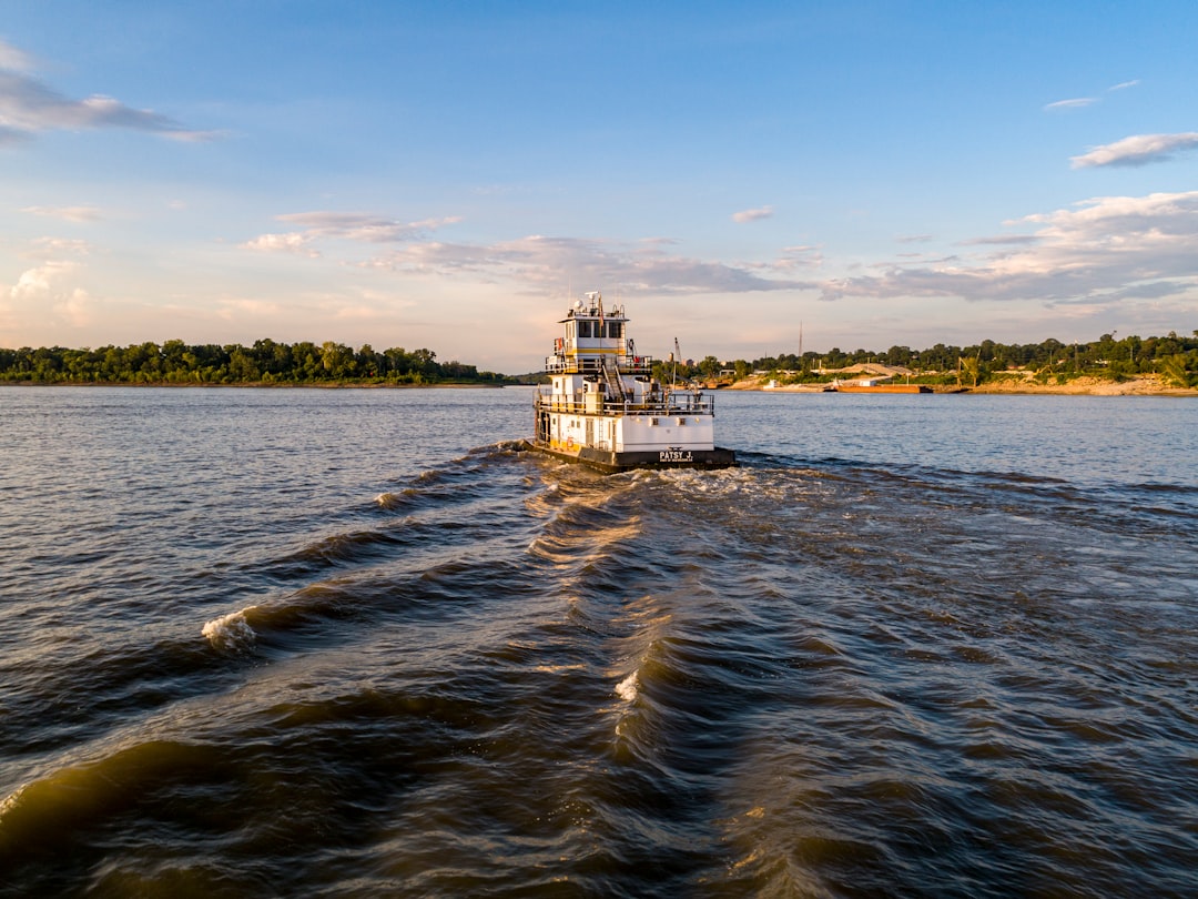
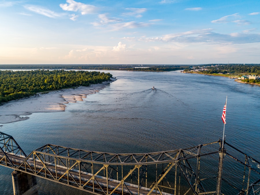
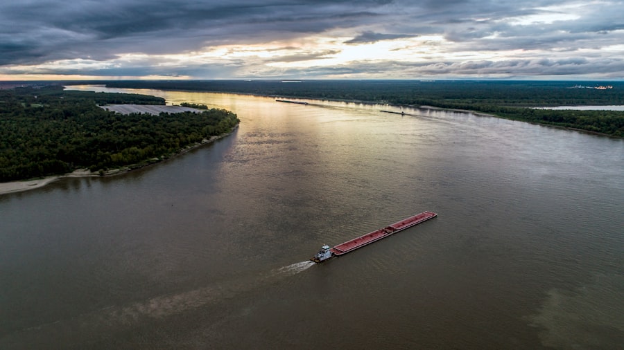
The rhythmic thrum of powerful engines, the steady glide of a towboat through the labyrinthine channels, and the formidable responsibility etched onto the face of its captain – these are the hallmarks of life on the Mississippi River. Navigating the “Big Muddy” with its ever-shifting currents, unpredictable shoals, and bustling commercial traffic presents a unique and demanding challenge. Among the multitude of critical elements a tow captain must meticulously consider, the concept of draft advisory stands paramount. This advisory, a nuanced and dynamic assessment of a vessel’s submerged depth relative to the available water depth, acts as a primary safeguard against groundings and ensures the efficient and safe transit of millions of tons of cargo annually.
The draft of a vessel refers to the vertical distance between the waterline and the bottom of its hull. For a towboat and its accompanying barges, this measurement is not static; it fluctuates based on numerous factors. A thorough comprehension of draft and its implications is fundamental to safe operations. The recent developments in the Mississippi River infrastructure have significantly improved transportation efficiency.
Components of Draft Calculation
Accurate draft determination involves a synthesis of several variables. The captain must consider the inherent design draft of the towboat itself, which is typically well-documented. However, the true challenge lies in calculating the combined draft of the entire tow.
- Barge Loading: Each barge within a tow carries a specific cargo, ranging from grains and petroleum products to chemicals and aggregate. The weight and distribution of this cargo directly impact the barge’s submersion and, consequently, the overall draft of the tow. The captain relies on meticulous loading manifests and experienced observation to estimate individual barge drafts.
- Fuel and Water Levels: The towboat itself consumes fuel and water, which contribute significantly to its displacement. As fuel tanks deplete, the towboat’s draft can subtly lighten. Conversely, freshly bunkered fuel will increase its submerged depth.
- Ballast Water: Some towboats and barges utilize ballast tanks to adjust trim and stability. The amount of ballast water carried will directly influence the vessel’s draft. Active management of ballast can be crucial for navigating shallow areas or maintaining optimal steering characteristics.
The Criticality of Clearance
The margin between the bottom of the tow and the riverbed, known as clearance, is a non-negotiable safety factor. Insufficient clearance leads inevitably to groundings, incidents that can have severe consequences.
- Grounding Risks: Groundings can result in hull damage, cargo spills, navigational channel obstruction, and significant financial losses due to delays, salvage operations, and environmental remediation. In extreme cases, a grounding can lead to hull breach and even sinking.
- Economic Impact: Beyond the immediate costs of an incident, groundings disrupt the flow of commerce on the river. A blocked channel can halt traffic, creating a ripple effect across the supply chain, impacting industries far beyond the river’s banks. The Mississippi River is a vital artery for the American economy, and any disruption carries a substantial economic toll.
The recent draft advisory for Mississippi River tow captains has raised concerns about navigation and safety on one of America’s most vital waterways. For more insights on this topic, you can read a related article that discusses the implications of low water levels and the challenges faced by the shipping industry. Check it out here: Mississippi River Navigation Challenges.
Sources and Interpretation of Draft Advisory Information
Towboat captains on the Mississippi do not operate in a vacuum. A sophisticated network of information continually feeds into their decision-making process, especially concerning draft advisories. These advisories are dynamic, reflecting the ever-changing nature of the river.
Official River Information Services
Government agencies play a pivotal role in disseminating critical navigational data, acting as the custodians of river intelligence.
- U.S. Army Corps of Engineers (USACE): The USACE is the primary authority for maintaining and monitoring the navigable waterways of the United States. They conduct hydrographic surveys, determine controlling depths in various reaches, and issue daily or weekly “Notice to Mariners” or “River Bulletins.” These bulletins often contain crucial draft advisories for specific stretches of the river, identifying areas of reduced depth, recent dredging activities, or other navigational hazards. They are, in essence, the river’s official weather report, but for depth.
- U.S. Coast Guard (USCG): While the USCG focuses more on safety and regulatory enforcement, they also contribute to draft advisory information through their broadcasts of Local Notice to Mariners (LNM) or other navigation alerts. These alerts might relay information about temporary obstructions or changes in channel conditions that impact safe draft.
Commercial and Private Information Networks
Beyond official channels, a robust network of industry-specific resources supplements the information stream, often providing more granular and real-time insights.
- Towboat Company Internal Updates: Many large towboat operators employ dedicated river dispatchers and even fleet hydrologists who analyze trends, integrate official data with their own observations, and disseminate advisories to their captains. These internal updates can be highly tailored to the specific routes and tow configurations of the company.
- Tow Captain Communication: A camaraderie exists among tow captains, and sharing real-time observations is common and highly valued. Via VHF radio or satellite communication, captains frequently exchange information about recent soundings, observed depths, and successful transit strategies for challenging areas. This informal network forms a crucial layer of experiential knowledge. Think of it as a community of seasoned navigators sharing their collective wisdom to avoid unseen obstacles.
- Private Hydrographic Survey Companies: Some commercial entities specialize in conducting their own detailed hydrographic surveys, especially in areas of high traffic or known shoaling. They then offer this data, often with higher resolution and more recent updates than official sources, to towboat companies on a subscription basis.
Factors Influencing Draft Advisories
The river is a living entity, constantly sculpted by powerful natural forces and human intervention. These factors directly translate into fluctuations in available water depth and, consequently, changes in draft advisories.
Hydrological Conditions
The flow of water – its volume and velocity – is the primary sculptor of the riverbed.
- Precipitation and Runoff: Heavy rainfall upstream can lead to increased river stages (water levels). While seemingly beneficial, a rapid increase in velocity can scour some areas deeper while depositing sediment in others, creating new shoals. Conversely, prolonged drought conditions lead to drastically lowered river stages, exposing previously submerged hazards and significantly restricting safe draft.
- River Stage Fluctuations: The Mississippi experiences significant seasonal and even daily variations in its water level. A difference of even a few feet can dramatically alter the navigable depth in shallow reaches. Captains meticulously monitor river gauges in real-time, understanding that yesterday’s safe draft may be tomorrow’s grounding risk.
- Current and Scouring/Deposition: The powerful currents of the Mississippi are relentless excavators and depositor. In bends, the outer bank is often scoured deeper, while the inner bank accumulates sediment. Bridges and other structures can create eddies that lead to localized scouring or deposition. A captain must anticipate these hydrological dynamics and their impact on available water depth.
Bottom Composition and Riverbed Dynamics
The material comprising the riverbed also plays a significant role in how it reacts to currents and how “soft” a potential grounding might be.
- Sand and Silt: Much of the Mississippi’s bottom is composed of sand and silt, which are highly mobile. These materials are easily eroded and redeposited, explaining the river’s constant state of change. A channel that was deep last week can be shallow this week due to shifting sandbars.
- Clay and Rock: Some sections of the river, particularly in its upper reaches or where it cuts through bedrock, have more stable bottoms composed of clay or rock. These areas tend to have more consistent depths, though grounding on rock is far more damaging than on soft sand.
Anthropogenic Influences
Human activities, while aimed at improving navigability, can also temporarily or permanently alter river dynamics.
- Dredging Operations: The USACE regularly conducts dredging to maintain authorized channel depths. While essential, dredging operations can create temporary hazards (dredge pipes, buoys) and alter current patterns in the immediate vicinity. Knowing the location and status of current dredging projects is crucial.
- Channel Maintenance Structures: Wing dams, dikes, and revetments are engineered structures designed to guide the river’s flow and maintain a desired channel. While beneficial in the long term, their construction or modification can temporarily alter depths and currents, requiring careful navigation.
Navigating with Draft Advisories: A Captain’s Workflow
The process of integrating draft advisory information into a safe transit plan is a complex multi-stage workflow, demanding continuous vigilance and proactive decision-making.
Pre-Voyage Planning
Before a tow ever leaves the fleeting area, the captain embarks on a meticulous planning phase, where draft advisories are a cornerstone.
- Route Analysis: The captain will meticulously review the planned route, cross-referencing it with the latest USACE River Bulletins, Notices to Mariners, and company-specific advisories. They will identify any reported shallow areas, controlling depths, or potential pinch points.
- Tow Configuration and Loading: Based on the lowest anticipated controlling depth along the route, the captain (in consultation with shoreside operations) may adjust the tow’s configuration (e.g., fewer barges, lighter loading, different barge arrangement) to ensure adequate clearance. This proactive measure is often far more cost-effective than attempting to lighten a grounded tow.
- Contingency Planning: The captain will develop contingency plans for encountering unexpectedly shallow water. This might involve identifying safe anchoring locations, potential fleeting areas for lightening the tow, or alternative routes if available.
During Transit Adjustments
The real-time application of draft advisories is where the captain’s skill and experience truly shine. The river is a dynamic entity, and plans must be flexible.
- Constant Monitoring: The captain constantly monitors several key indicators: the vessel’s draft (often displayed via electronic systems), the depth sounder (fathometer) readings, and the current river stage. They are also keenly observing the river itself, looking for visual cues of shallow water, such as ripples, discoloration, or stationary debris.
- Speed and Maneuvering Adjustments: When approaching an area of reduced depth, the captain will reduce speed to minimize the effects of “squat” (the phenomenon where a vessel traveling at speed settles deeper into the water) and to allow for more precise maneuvering. They may also adjust the tow’s alignment or trim to provide additional clearance, sometimes by carefully “flanking” the tow through a narrow or shallow passage.
- Communication and Reporting: Should a captain encounter depths shallower than advised, or observe a new hazard, they are obligated to report this information to other mariners and relevant authorities (USCG, USACE). This real-time reporting enriches the entire navigational information network.
The recent draft advisory for Mississippi River tow captains has raised concerns about navigation safety and operational efficiency. For those interested in understanding the broader implications of this advisory, a related article discusses the challenges faced by the shipping industry in maintaining river traffic during low water conditions. You can read more about it in this insightful piece on MyGeoQuest, which highlights the importance of adapting to changing environmental conditions while ensuring the smooth flow of commerce along one of America’s vital waterways.
Technological Advancements in Draft Management
| Date | Location | Draft Advisory (feet) | Current River Depth (feet) | Recommended Tow Draft (feet) | Notes |
|---|---|---|---|---|---|
| 2024-06-01 | Upper Mississippi (Mile 200-300) | 9.0 | 10.5 | 8.5 | Normal conditions, no restrictions |
| 2024-06-01 | Middle Mississippi (Mile 300-500) | 8.5 | 9.0 | 8.0 | Low water advisory in effect |
| 2024-06-01 | Lower Mississippi (Mile 500-700) | 7.5 | 8.0 | 7.0 | Reduced draft recommended due to shoaling |
| 2024-06-02 | Upper Mississippi (Mile 200-300) | 9.2 | 10.7 | 8.7 | Improved conditions after recent rains |
| 2024-06-02 | Middle Mississippi (Mile 300-500) | 8.3 | 9.1 | 7.8 | Stable water levels |
| 2024-06-02 | Lower Mississippi (Mile 500-700) | 7.4 | 7.9 | 6.9 | Ongoing shoaling, caution advised |
Technology has become an indispensable ally in the tow captain’s quest to navigate the Mississippi safely and efficiently. These tools provide enhanced situational awareness and predictive capabilities.
Electronic Chart Display and Information Systems (ECDIS)
Modern towboats are equipped with sophisticated electronic charting systems that integrate vast amounts of data.
- Real-time Depth Integration: ECDIS displays can overlay real-time depth sounder readings directly onto navigational charts. This visual representation allows the captain to see the contour of the riverbed relative to their vessel’s position and planned track line.
- Predictive Navigation Tools: Advanced ECDIS systems can incorporate vessel draft, squat models, and predicted river stages to highlight areas where insufficient clearance is anticipated, providing visual and audible alerts to the captain. This predictive capability is akin to having a crystal ball, allowing for proactive adjustments.
- Official Chart Overlays: Digital versions of official USACE navigation charts, showing controlling depths and channel limits, are seamlessly integrated into ECDIS displays, providing the authoritative baseline data.
Global Positioning Systems (GPS) and Differential GPS (DGPS)
Precise positioning is paramount for accurate navigation, especially when dealing with fine margins of depth.
- High-Accuracy Positioning: GPS, and particularly DGPS or RTK (Real-Time Kinematic) systems, provide highly accurate positioning information, often down to a few centimeters. This precision is vital for staying within narrow dredged channels and avoiding known shoals.
- Track Line Navigation: Captains can create and follow precise track lines (pre-planned routes) on their ECDIS, guided by GPS. This allows them to consistently navigate the deepest part of the channel, even in low visibility or challenging conditions.
- Grounding Avoidance Alarms: Many systems can be configured to sound an alarm if the vessel deviates too far from a pre-defined channel width or approaches a known shallow area within a specified safety margin.
Multi-Beam Echosounders and Sonar
While standard single-beam depth sounders have been a staple for decades, more advanced sonar technology offers a significantly enhanced view of the riverbed.
- Detailed Bottom Mapping: Multi-beam echosounders sweep a wide swath of the riverbed, creating a highly detailed, 3D topographical map. This allows captains to visualize submerged features, identify scour holes, and detect subtle changes in the bottom contour that a single-beam sounder might miss.
- Obstacle Detection: In addition to mapping depth, multi-beam sonar can identify submerged obstacles such as snags, sunken debris, or even temporarily lost cargo, providing crucial warnings.
- Real-time Situational Awareness: The visual output of multi-beam sonar, often displayed on the ECDIS, provides an almost “underwater view” of the riverbed, significantly enhancing the captain’s real-time situational awareness. It is like having X-ray vision for the river bottom.
The Human Element: Experience and Judgement
While technology provides invaluable tools and data, the ultimate responsibility for safe navigation and the interpretation of draft advisories rests squarely on the shoulders of the tow captain. Their experience and judgment are the irreplaceable pillars of safety.
Intuition and Local Knowledge
Years of navigating the Mississippi imbue a captain with an almost intuitive understanding of the river’s moods and idiosyncrasies.
- Reading the River: Experienced captains develop an uncanny ability to “read the river” – interpreting subtle visual cues, such as the pattern of ripples, the color of the water, or the behavior of shorelines, to infer depths and current patterns. This instinctive understanding often complements and even precedes technological warnings.
- Historical Data and Trends: A seasoned captain carries a mental map of the river’s historical behavior. They know which areas are prone to shoaling during low water, or where swift currents typically create scour. This deep historical context informs their interpretation of current advisories.
- Sounding Pole Expertise: Despite advanced electronics, the simple sounding pole remains a valuable tool, especially in very shallow, soft-bottomed areas. A captain or deckhand can physically probe the bottom to gauge the “give” of the sediment, which electronic sounders might sometimes misinterpret as hard bottom.
Decision-Making Under Pressure
The river environment often presents rapidly evolving situations, demanding quick and sound decisions from the captain.
- Risk Assessment: Every decision, especially when navigating shallow waters, involves a continuous risk assessment. The captain weighs the risk of grounding against the need to maintain schedule, considering factors like tow size, cargo type, weather conditions, and proximity to safe havens.
- Leadership and Crew Coordination: During critical maneuvers in shallow areas, the captain’s leadership and ability to effectively communicate with and direct the crew (e.g., lookout, steersman, deckhands on the sounding pole) are paramount. A well-coordinated team is essential for safe passage.
- Adaptability: The Mississippi River is a dynamic and unpredictable environment. The most effective captains are those who can adapt their plans and strategies in real-time, embracing the river’s ever-changing nature. Sticking rigidly to a pre-conceived plan in the face of new information can be a recipe for disaster.
In conclusion, navigating the Mississippi River with its immense commercial significance requires a sophisticated approach to draft advisory. It is a constantly evolving challenge demanding a harmonious blend of cutting-edge technology, comprehensive official and commercial data, and, crucially, the unparalleled experience and judgment of the tow captain. Their vigilance in interpreting the myriad of factors influencing safe draft ensures the continuous, efficient, and secure flow of vital commerce along this iconic American waterway. The captain, in essence, is the river’s interpreter, translating its ever-changing whispers of depth into precise and safe navigational decisions.
WATCH THIS! 🚨CRACKING: Why America’s $5 Trillion Dam is Failing Right Now
FAQs
What is the Mississippi River Tow Captain Draft Advisory?
The Mississippi River Tow Captain Draft Advisory is a guideline issued to inform tow captains about recommended draft limits for vessels navigating the Mississippi River. It helps ensure safe passage by considering current river conditions such as water depth and flow.
Why is the draft advisory important for tow captains on the Mississippi River?
The advisory is important because it helps tow captains avoid grounding or damaging their vessels by providing updated information on safe draft limits. This is crucial for maintaining safe navigation and preventing accidents on the river.
How often is the Mississippi River Tow Captain Draft Advisory updated?
The advisory is typically updated regularly, depending on changes in river conditions such as water levels, sediment buildup, and weather events. Updates may occur weekly or as needed to reflect current navigation conditions.
Who issues the Mississippi River Tow Captain Draft Advisory?
The advisory is usually issued by river authorities or agencies responsible for navigation safety on the Mississippi River, such as the U.S. Coast Guard, the U.S. Army Corps of Engineers, or local river management organizations.
How can tow captains access the draft advisory?
Tow captains can access the advisory through official channels such as government websites, navigation bulletins, maritime communication systems, or direct notifications from river authorities.
Does the advisory apply to all types of vessels on the Mississippi River?
While primarily intended for towboats and barges, the advisory can be relevant to any vessel navigating the river that must consider draft limitations to ensure safe passage.
What factors influence the draft limits recommended in the advisory?
Factors include current water depth, riverbed conditions, recent sediment deposits, water flow rates, weather conditions, and any ongoing river maintenance or dredging activities.
What should tow captains do if their vessel’s draft exceeds the advisory limits?
Tow captains should adjust their cargo load to reduce draft, delay transit until conditions improve, or seek alternative routes if possible to comply with safety recommendations and avoid grounding.
Is the Mississippi River Tow Captain Draft Advisory legally binding?
The advisory serves as a safety guideline rather than a legal mandate. However, following it is strongly recommended to ensure safe navigation and avoid potential liability or accidents.
Where can I find more information about navigation safety on the Mississippi River?
Additional information can be found through the U.S. Coast Guard, U.S. Army Corps of Engineers, maritime industry organizations, and official river navigation websites. These sources provide updates, safety tips, and regulatory information.